Showing posts with label filling gaps. Show all posts

Friday, August 16, 2024

Lenggries to Brannenburg, Day 5: Bayrischzell to Brannenburg via Wendelstein

Our final day of gap closing took us up the Wendelstein and down to Brannenburg. The Wendelstein is a popular peak for tourists, made easily accessible by gondola from Bayrischzell and cog train from Brannenburg, so we encountered lots of people at the top, but only a few on the trails.

Heading up:


Well would ya look at that: signage for the Koenig Maximilian Weg. Hello, old friend. We had two directions to choose from as we approached the top of the mountain, so of course we took Maximilian's route.


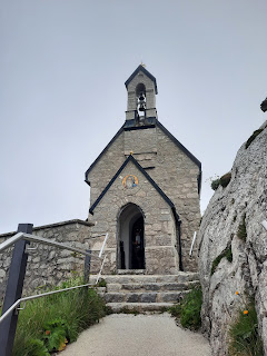
A chapel greeted us near the top...


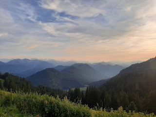
...with the sort of views we had come to expect:


We paused to enjoy some Kuchen, and then joined many other tourists hiking the Panorama Weg around the top. The route included a tunnel...


...and, as the trail's name suggested, abundant would-be panoramic views:


As we reached the astronomical observatory at the tippy top, the clouds began to clear...


...at least looking up. In every other direction, the views were remarkably similar:

In theory, Hohenpeissenberg is visible yonder...

Posing with a pair of lovers by Erika Maria Lankes


As we headed back down,...

Can you spot the chapel below?

...the clouds finally cleared...

The trail zigged and zagged


...and we could see all the way into the valley below.


We then began the long descent...


...down...


...to...


We didn't take the train, but we waved as it passed by

...Brannenburg. We celebrated with gelato and pizza before hopping on the Regiobahn and S8 back to Steinebach.  


Grand total for our five days' effort: 65 miles, ~16,500 ft elevation gain.

Friday, August 9, 2024

Lenggries to Brannenburg, Day 2: Buchsteinhuette to Rottach-Egern / Tegernsee

On Friday, we set off down from the Buchstein hut and then up a series of low peaks. We paused in a flat notch in front of the Schwarzentenn Alm, to unzip long pants legs, and watched three frolicking young cows playfully butting heads and chasing each other through the meadow--a reminder to love animals, not eat them.

We headed uphill. As we passed an Alm below our first peak, Hirschberg, someone called out to us to ask if we knew where we were going. S assured them we had maps, and they replied, "well, you can use a map, or you can ask the locals what the best way up is." He directed us off trail, up through the field ("it's closed earlier in the summer for nesting birds, but they're done now, and I've mowed a path for kids and barefoot people"). So of course, we took the recommended route.


Komoot had warned us that our intended trail was currently closed, but the host at the Buchsteinhuette had called the forest service, who confirmed it was open--yet we saw a sign as we approached the peak asserting otherwise. (A sign lower down prohibited skis and snowshoeing; the sign at the top included hikers as well.)


From the top of Hirschberg, we had fine views of the Tegernsee.


Der Wanderer ohne Nebelmeer


We headed back down the hill, eventually pausing for lunch at the Hirschberghaus, then continued past the Kratzer Gipfelkreuz and began a steep descent, supported by somewhat floppy cables for hikers to grab onto. Had we been ascending, the acrophobe would have been speedy; descending, with constant views of the steep drops below, made the acrophobe slow and chatty.

Eventually the trail joined up with gravel-paved forest roads, followed by another steep descent through the woods to a radio tower, where we had another fine view of the lake.


From there, we descended past Duke Luitpold's 1912 fairytale castle Schloss Ringberg, now owned by the Max Planck Institute...

C' had accompanied V at a conference here, years ago


...and into Rottach-Egern, our destination for the evening. We were happy to finally reach our Gasthaus for the night and drop our packs. 

S needed to catch a train in Tegernsee, and the quickest route involved taking a rowboat ferry across the southern end of the lake. The boat stopped operating at 6pm, and we had 13 minutes to get there. Kudos to C', who speed-walked 0.86 miles and arrived just in time to hail the rower, who had just left the dock. He turned around, and we enjoyed the ride across.


We had a little time to be tourists as we headed toward the Bahnhof. We stopped inside the Schlosskirche, St. Quirinus...


Passing one of several ferry docks, we discovered that C' and I could still catch the last motored ferry back to Rottach-Egern. Since S had some time before his train left, instead of walking him all the way to the station, we aimed instead for a gelato shop and ate sorbetto next to the ferry dock before parting ways. S was heading back to the U.S., while C' and I still had three days of hiking ahead.

Thursday, August 8, 2024

Gap filled, and Lenggries to Brannenburg Day 1: Lenggries to Buchsteinhuette

Ta da! Before and after--lots of walking this summer.


Our Durham friend C' flew to Germany to attend a Taylor Swift concert in Hamburg with her daughter. Lucky her! And lucky us, because afterward she took a train south to hike from Lenggries to Brannenburg with me; S joined us for the first two days.

Turns out that when hut/hotel staff cheerfully ask, "where're you coming from/headed?", no one expects you to say "we're hiking from Lenggries to Brannenburg." It took me until our penultimate day to get the gap-filling explanation down auf deutsch. The filled gap is visible just southeast of Munich in the video above.

Day 1: Lenggries to the Buchsteinhuette:

Early morning at the S-Bahnhof

We hopped onto the S8 and then a Regiobahn, both courtesy of the 49-Euro Deutschland Ticket, and two hours later arrived in Lenggries. After topping ourselves off with Milchkaffee and Quarktaschen at a bakery, we headed up into the Voralpen.

Cows awaited near the Seekarkreuz:


Views from 1,601m:


There followed a Komoot-forewarned stretch that required clambering down some big rocks, with assorted opportunities for falling a long way down, that put the acrophobe on heightened alert and made her chatty chatty chatty, but she survived and proclaimed it easier than the snow-melt waterfalls above Rifugio Taramelli but harder than the hike from Herzogstand to Heimgarten (which I can't believe I failed to blog about last year, given all the build up in 2017). 

Once down, we headed up again, eventually approaching the Roßsteinalm:

Check out the rocks holding the roof down

The Almmaedl were apparently all joyfully skipping and singing their way up to the Tegernseer Huette, but they had left self-serve cake and cold drinks behind. 


After pausing for Johannisbeer-Apfel Schorle, we hiked up to the Tegernseer Huette, nestled on the rocks between the Roßstein and Buchstein (both ~1,700m). I failed to take a single photograph, so here's an image courtesy of Wikipedia, shot from the trail up to the Buchstein:
After Kuchen and more Schorle and some time soaking in the great views at the Tegernseer Huette, we hiked down the hill, past Lumpy the Katze, who was hunting rodents in the meadow, to the Buchsteinhuette, our stop for the night, where we had dinner and learned Lumpy's name. Afterward, we hiked back up to the Roßsteinalm to watch the start of the sunset.


The Roßsteinalm Maedl were back from their afternoon frolic and delighted to spot us. They gleefully corralled us into a party celebrating their Midsommer--well past June 21, but the halfway point for their summer season up at the Alm. Schnapps flowed liberally (with the exception of a congealed Eierlikoer, which flowed very slowly), and tales of German-American couples finding cross-Atlantic love were deemed romantic all around. We fuddy duddies departed too soon, declining repeated offers to inhale magical Bavarian snuff, since we needed to make it back down the hillside before dark and lacked the sure-footedness and youthful energy of the locals.