Gentle reader, are you tired yet of photos of beautiful mountains? Good, because here are some more.
Taking things easy on our last full day in South Tyrol, we drove the steep shortcut zigzagging down into the Gadertal below Gschliererhof, then zigzagged up the hill on the opposite side. A little beyond Welschellen, we parked in the Sportplatz parking lot, then headed up by foot along rocky trails through the pine forest. Feeling energized, I bounded up the trail at a good zip, leaving a bewildered E and S to follow. We regrouped a few km later at the
Munt da Rina Alm, then continued up to Col dal Lé/Col dal Lech and the Glittner See.
I interrupt this scenic idyll for an aside about getting around on those hills. What a physically demanding place this must be to make an agricultural living. The hills are dotted with tiny farming communities that have been in the same families for generations. Fruit farms are in the flat valleys; on the steep hillsides, the agriculture is dairy and livestock. We were visiting during haying season, and farmers were out on the sloping hills, scything hay by hand--or occasionally using heavy machinery that tilted sideways at shockingly steep angles (our host said sometimes they tip over, and "then, yes, it's not so good"). After scything, they rake or blow the hay down the hills and into the narrow roads, and then scoop it by hand onto tiny trucks. Everyone is made entirely of muscle. When drivers encounter haying trucks, they wait patiently for the farmers to finish scooping up hay; then the farmers either back up (uphill!) or drive forward to the next farm entrance or pull-off to let the cars pass, before continuing their work. Tourism must be a real boon.
But back to the hike...Some views at the top of Col dal Lé:
 |
| Peitlerkofel |
The obligatory 360
o view:
The trails were understandably popular with mountain bikers as well as hikers.
From the top, it was a short walk around the next rise to the Glittner See. Before we reached the lake, we passed some
Vor-lake ponds-turned-puddles that hosted lots of salamanders.
We then attempted to admire the lake, in the middle of which sits a wooden boat designed by 25 architecture students and faculty at Uni Innsbruck with the theme "radically romantic."
The boat was installed in 2013 and was supposed to go up in flames for the Herz-Jesu-Fest in June 2015. The Tyrolean tradition of
burning things for Herz-Jesu-Fest dates back to a 1796 campaign of the French Revolutionary War, when leaders of the Tyrolean army organized a Tyrol-wide prayer for success and managed to beat back Napolean's troops. For better or for worse, the boat on Glittner See has yet to combust.
I suspect that even in the best of times, the Glittner See is not particularly dramatic, but the drought has made it so sadly unglamorous that I took not one photo of it, to my documentary regret--but here's a pretty accurate photo borrowed from the interwebs...
...and another, from a more artfully contrived angle, courtesy of the Munt da Rina Alm website:
After watching some mountain bikers repair the electrified cattle fence they accidentally rode through at the lake, we headed back to the Gipfelkreuz for one more look at the stunning views...
...then headed back down...
 |
| Zehnerspitze und Kreuzkofelgruppe. Fanes is behind those mountains. |
...to the Alm for lunch. I likewise failed to take a photo of the Alm (you can see one
here), but I did take a photo of the bathroom toilet lid...
...and a snoozing dachshund, both of which I hope capture some of the laid back vibe.
Then it was back down...
...down...
...and down some more, to the parking lot, where lupines were thriving in front of the dumpster that I carefully cropped out of this photo.
By then it was only early afternoon, so we drove to nearby St. Martin in Thurn to visit the
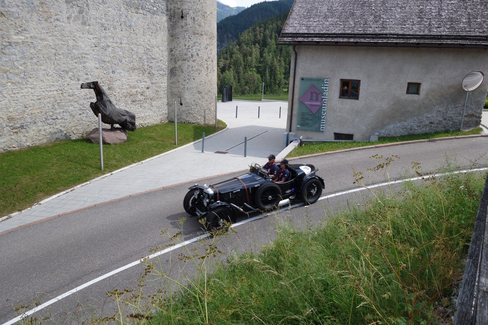
Museum Ladin Ćiastel de Tor to learn more about Ladin culture and history. An outing of antique roadsters followed us into town.
The museum, housed in a 13th-century castle, is small, charming, and packed full of folk and historical items, pictures, stories, and displays describing the Ladin people and their land from pre-history onward.