Showing posts with label badenweiler. Show all posts

Thursday, June 13, 2024

Basel to Staufen Day 2 - Kandern to Britzingen

Wednesday June 5, Kandern to Britzingen

The day began with a hike uphill to Schloss Buergeln, a Rococo castle built in the 1760s for the provost of Buergeln. Komoot reviews were enthusiastic about the views and gardens, so I decided to skip the local big mountain, the Blauen (1165m), and enjoying the castle grounds instead.

My camera is bad with slopes. Imagine a hillside here.

Farm buildings in Sitzenkirch, in the foothills of the Blauen.

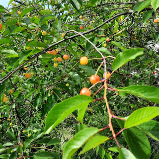
Baden-Wuerttemberg is the fruit basket of Germany, and I passed many cherry and pear and apple trees on my way uphill. I didn't pick a single cherry...


As the trail wended higher, I entered the woods, continuing up. Lots of foxglove in bloom, mostly pink, with a lone white stalk.


Eventually I emerged at the top of the hill and entered the grounds of the castle, which were pretty, but a little disappointing given the rave reviews on Komoot. I mean, the views were nice, but why go for run down diminutive Rococo when you can get similar views at half-demolished big stone ruins instead?


As I continued hiking north, I caught a glimpse of the Blauen, no longer far off, and decided that the disappointment of Schloss Buergeln could only be remedied by climbing up a higher mountain. 

A sign on the side of Kalte Kueche (Cold Kitchen), a D.A.V. hut in the woods, directed me to Blauen--just 3km away! 


Another half kilometer up the trail, a sign aimed me at Blauen--still 3km away, thanks to the magic that is trail signage in Germany.


After another 2km or so of hiking, another set of trail signs pointed me to the peak, either 0.2 km away or 1.2 km away, depending on whether one wants to walk toward it or away from it. This suggests infinite other possibilities as well, if one prefers to walk back and forth on the trail for a few hours before deciding finally to arrive.


The acrophobe climbed halfway up this tower, which was good enough for some distance views. 


The hike down to Badenweiler was lovely, with wide trails, lovely trees, easy switchbacks, and this shiny Carabus auronitens.


Next stop, Badenweiler, cuz ruins. And not just 12th-c.-Burg-destroyed-by-peasants/Swedes/French-in-the-Bauernkrieg/Thirty Years' War/Dutch War ruins, but Roman ruins as well, because the Romans knew a great spot for a dip in thermal springs when they saw one.

Clomping into town, I passed the Pauluskirche. The first mention of a church on this site was in 774 CE; when the current church replaced a Gothic version in the 1890s, builders found remains of multiple previous church iterations, and underneath them all, the walls of a Roman temple from ca. 145 CE.  


Next stop: Burg Baden, atop the hill above the Kur- und Festspielhaus (a building erected in the 1970s with an architectural style reminiscent of The Jetsons. It makes quite the contrast with the Burgruinen).


Note the Ukraine flag
Next stop, ingestion of calories at the cafe on the Kurhaus patio...


...followed by a visit to the Roman bathhouse.


From the bathhouse ruins, it was a leisurely stroll through Badenweiler's "Park of the Senses," filled with hands-on exhibits with which to hear, see, touch, and smell... 


...then through vinyards and woods...


...to small town Britzingen, my destination for the night.


Staufen in the distance!

Ta da! ~16.5 miles, 3,350 ft elevation gain.


Sunday, October 18, 2009

Badenweiler and a ruins triple whammy

If one remembered to bring one's bathing suit (which, of course, we didn't), where would one go for a thermal cure around here? Scenic Badenweiler, of course! This morning, we drove 30 km south to this posh tourists' mecca, merely looking for non-rain. We realized it was a vacation destination when we noticed all the people out and about and all the stores open for business--in Germany on a SUNDAY.

Folks have been enjoying mineral cures in Badenweiler for at least a few millennia. The name "Badenweiler" means "Bath town;" the Romans, who also knew the pleasures of a good hot soak, had called it Aquae Villae. ("Villa" and "Weiler" are etymologically related; the German and Roman names mean the same thing.) In addition to access to the toasty hotsprings, the location provided the Romans with a strategically advantageous view of the upper Rhine Valley. Celts who were living in the area before the arrival of the Romans were assimilated into the town.

The ruins of an elaborate Roman bathhouse were unearthed in the 1780s. An excavated stone indicates the spa was dedicated to the goddess Diana Abnoba--a name that blends the Roman goddess of the hunt (Diana) with the Celtic goddess of the Black Forest (Abnoba). Today, the ruins are protected from the elements under a huge, arched glass ceiling.

No strategically advantageous view of the upper Rhine Valley would be complete, of course, without a 12th-century Burg built by the local nobility (Zaehringers, in this case), destroyed by angry peasants during the Bauernkrieg of 1524-25, further trampled during the Thirty Years' War, and rebuilt in the 17th century before being emphatically and permanently pounded back down by the French (1678). Yadda yadda, same ol', same ol'--and yet, how they beckon! Elias gave them a B+ (good variety, but not as extensive as Hochburg).

Badenweiler rests beneath the 1165m Blauen, so we decided to take a quick hike up to the peak. As is often the case, our "quick hike" morphed into an almost 10-mile trek through multiple ecological and climatological zones and ever-changing weather conditions. Our initial ascent was under bright sunshine with intermittent rain that shifted into fog. By the time we reached the Wirtshaus (inn) at the top of the Blauen, we were tromping through a few inches of snow. Elias, who hadn't been so thrilled by the steep climb, was beside himself with glee, thanks to the snowball lobbing opportunities.

After refreshing ourselves with nutritious ice cream and french fries, we continued along the ridge to the neighboring Stockberg (1076m), site of more ruins. Sometime around the birth of Christ, plus or minus 500 years, the Celts built a circular stone wall up there, possibly for use as a lunar observatory (according to our little Badische Zeitung pocket hiking guide). Given that these ruins are about three times as old as the Burg Badenweiler ruins down below, it was no wonder they were a little more ramshackle.

By the time we made it to Stockberg, it was surprisingly late, and we were worried about getting out of the woods before the sun set. We picked up the pace, and Elias earned major brownie points for his endurance and good cheer.