Showing posts with label fauna. Show all posts

Friday, August 14, 2026

St. Ulrich to Trieste, Day 2 - Colfosco to Rifugio Valparola

Monday June 22, Colfosco to Rifugio Valparola

Our day began by continuing through the valley toward Corvara.


Shortly after emerging from the woods, we crossed a bridge. Sometimes S likes to test questions like "do my boots leak?," so he engaged in the scientific method to find out. This was a way better question to test than his 2023 pre-long-distance hike question, "I wonder if I'm allergic to poison ivy?" (The answers were yes and yes, respectively.)


My Rules of Acrophobia permit gondola lifts when necessary (immersion therapy) but forbid chair lifts. We admired this one from the comfort of solid ground.


Most of the day's elevation gain involved switchbacks, but occasionally it was a straight shot up. We were heading up to the Pralongia plateau, known as "the Amphitheater of the Dolomites" for its 360° panoramic views. (I could pretend I knew this when I planned our route, but I had no clue--it just looked like a sensible and scenic way to go.)


As we approached the Pralongia hut, where the 2-stage chair lift drops non-acrophobes off on the plateau, we took a short detour to admire the Marmolata massif in the distance. It's the highest mountain in the Dolomites at 3,343m. We've never been on "the Queen of the Dolomites," but S's mom H climbed and skied down it in the 1950s.


We paused at the hut for S's go-to hiking beverage (Apfelschorle), then continued on to more spectacular views.


The snow-capped peaks in the distance below are Austrian Alps. In 2023, we crossed over them into Italy somewhere just off to the left of the photo.


Wildflowers were abundant. 


The blue splashes below are forget-me-nots--in German, Vergissmeinnicht. I'm fascinated by the possessive pronoun mein in the middle instead of the accusative mich. Renate later explained to us that the old-fashioned mein is genetive--"forget of me not."


S suspected we were near Col di Lana, and soon we saw it ahead of us. Col di Lana is also known locally as Col di Sangue. Over 8,000 Austrians, Germans, Italians, and Hungarians died on this mountain over the course of WWI. On the night of April 17-18, 1916, after months of preparation, the Italian military blew the top off, with Austrian soldiers trapped in a fortification on top. Many of the via ferrata routes in the Dolomites were first installed to make it easier for soldiers to get up and down mountains on the front lines. 


We knew we had a pass to cross to reach Valparola. We intuited that it would be to the right of our lunch spot, but it turned out to be to the left (see the 90-degree turn to the north in the second map at the end of this post)...


Fanes Gruppe in the background. We hiked on the other side in 2017.


Trees favor protective rocks.


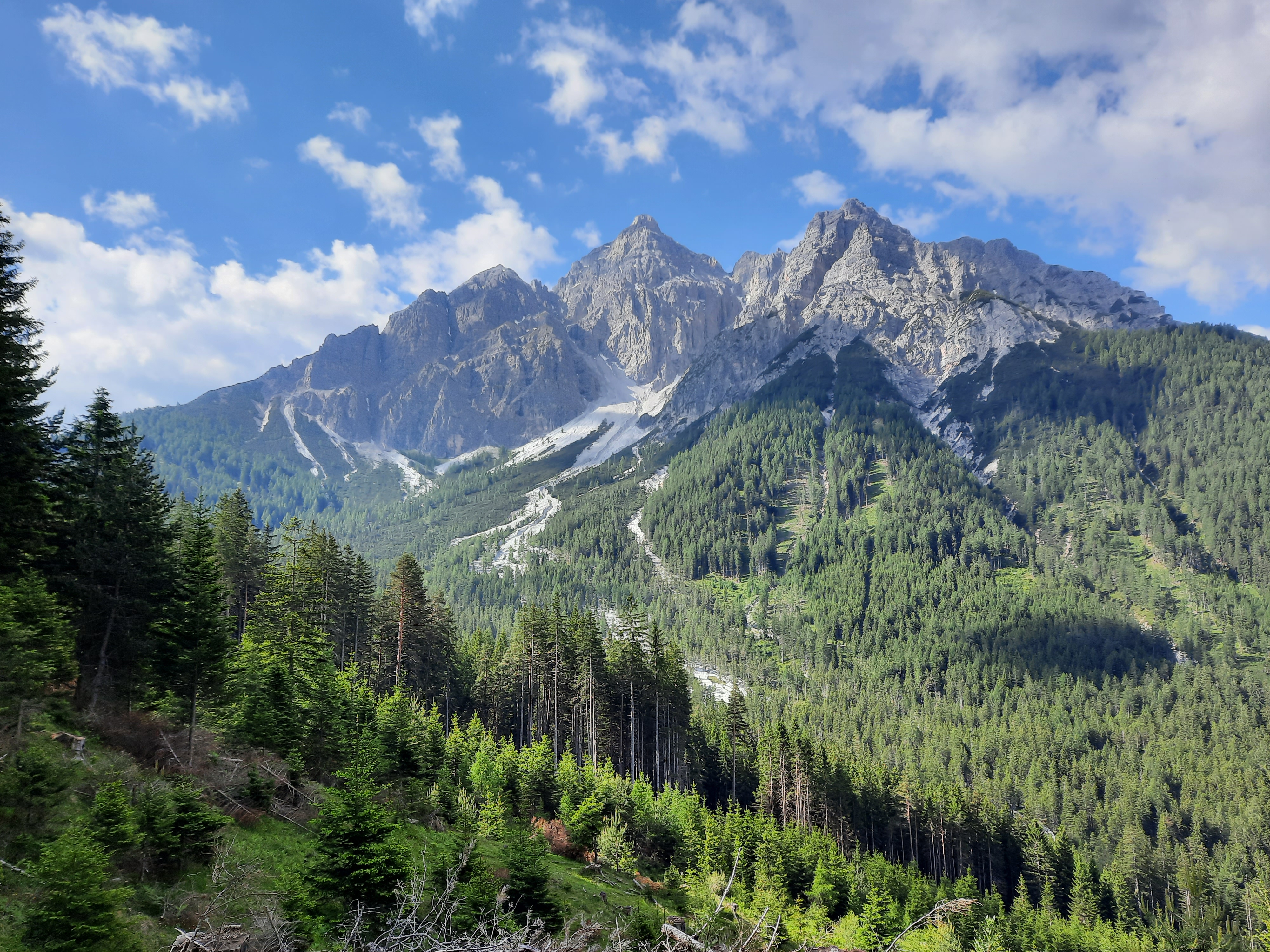
The big mountain beyond the trail is the Piz dles Cunturines, the highest peak in the Fanes group at 3,064m.


Blazes were essential along the last rocky stretch of the route. Often, there was no actual trail--the blazes just pointed in the general direction, and it was up to the hikers not to roll down the side of the rock. For this, the acrophobe deducted 3 points from the day's Acrophobe Approval score (+3 for the blazes, -6 for the long stretches of scrambling).


Notice the TWO blazes in this photo. We were hiking
down; up would probably have been easier.

It took until the end of Day 2 for us to finally see cows. I'm not sure why they were so scarce this summer. 


Once the blazes dropped us off at the end of the exposed rock, it was another mile or so to Rifugio Valparola. 

Rifugio room with a view


Ta da! 10 miles, 3,850' up, 2,250' down, 97% acrophobe approved.

Colfosco to Pralongia Hut

Pralongia Hut to Rifugio Valparola


St. Ulrich to Trieste, Day 1 - Seceda to Colfosco

Sunday June 21, Day 1: Seceda to Colfosco

Our long hike of 2026 began atop Seceda, which meant catching an early morning bus to St. Ulrich, and then riding the Seilbahn up. The Seilbahn is in two stages: an 8-person gondola from St. Ulrich, followed by a 62-person gondola at the halfway point. High tourist season had already begun, so were packed in with other tourists in the second lift--a convenient thing for acrophobes.

Here we are on Seceda before Day 1 kicked our butts. 


The National Park makes an effort to keep people on designated trails. Once the temporary railings end, folks sprawl out in the meadows.


For the first few miles of our hike, we hiked in single and double file with dozens of other hikers. It's a wonder that I snagged photos without lots of people in them. 

Langkofel and Plattkofel

I had to be right quick to get this shot between Wanderer/innen

The lure of Der Wanderer ueber dem Nebelmeer is strong for all of us camera-toting Caspar David Friedrichs. Note that the Wanderin standing on the rock in the photo below had to be photographed in multiple poses by her two friends. Then she traded places with one of the friends for a second round of photos. Then that friend traded places with the third friend for a third round of photos. Meanwhile, a long line had formed of other hikers who similarly wanted to take photos. It was a wanderer-eat-wanderer spot on the trail.


Eventually, we hiked far enough down the trail, and far enough from the Seilbahn station, that the day-hiking crowds trickled off. For the rest of the day, we encountered only long-distance hikers, many of whom were hiking the Alta Via 2.

Adjusting bootlaces in privacy

As we were in the Dolomites, I felt it necessary to admire a chunk of dolomite. The powdered dolomite in my glaze-ingredients cabinet in our basement back home is presumably similar in chemical content.


This first day of hiking coincided with E's 25th birthday. We waited until the evening to call him, since there was a 6-hour time difference. E has honed the skill of throwing rocks in the air and photographing them looking like spaceships. During an afternoon break, I tossed a few rocks in his honor, but being less skilled with aim, was lucky that I was wearing a protective hat when one of them hit me on the head. I eventually got a satisfactory photo (although the rock is out of focus). In the background whence we came, Geislergruppe.

Happy bday, E!

From there, it was a long hike up to the pass. Resilient wildflowers found places to send down roots in the scree.


At the top of the scree field, we reached the saddle and had an expansive view to the east.


The trail then followed the ridge around the cirque. Here's the first glimpse toward the upcoming death-defying thrill ride for acrophobes. I have no photos of the scariest bits, because I was too busy trying to be brave, but they involved precipitous cliffs and stainless steel cables.
 

Carly the Travel Chicken emerged from the backpack at the apex, where the narrow trail expanded into a comfortingly wide meadow. Another hiker arrived soon thereafter. She was hiking half of the Alta Via 2 solo, and was modeling both bravery and empowerment. 


S's microfiber towel makes a fine superhero cape.


I took this photo for the geology in the background, where you can see the angled layers of former ocean floor now high in the Alps.


Once we rounded this cirque...
 

...the terrain flattened out and the acrophobe could finally relax. 

Looking toward Val Lungo


Pair o' marmots...


Val Lungo...


Throughout our hike, we repeatedly encountered built-in steps designed for--or rather, by--people taller than 5'6".  

From one cirque to the next... 


Turn your audio on to hear the call of the marmots.

Despite hundreds of miles hiking in the Alps, this was the first and only time we saw Edelweiss in the wild, above Colfosco.


Audio on to hear the adorable baby goats above Colfosco, accompanied by a sheep who thought the goats were way more fun to hang out with than the sheep. 

Ta da! 11.5 of the day's 13.25 miles, 2,150' up, 4,750' down (oof).


Saturday, July 8, 2023

Walking to Italy - Day 8 - Mieders - Steinach

Day 8: Mieders to Steinach

I've just returned from my second long walking adventure of the summer, a 115-mile 7-day hike along the Donau (Danube) from Passau to Linz. S, meanwhile, is on the final leg of a 5-day bike tour through the Oetztal in the Alps with his cycling buddy S. I think this means I have two undistracted hours left to finish blogging about the last four days of our Walking-to-Italy hike.

So where were we...

We headed out of Mieders along the Pilgerweg (pilgrim's path) toward Maria Waldrast (Mary Rest-in-the-Woods), a pilgrimage monastery that dates to the 15th century. As the legend goes, two boys from Matrei discovered an image of Mary growing out of a tree trunk on the mountain. It was hacked out and brought down to Matrei, and after a few years, a monastery was built near the site of the old tree trunk, and the image was brought back up the mountain. The monastery was expanded in the 17th c., reached its heyday in the 18th c., was closed and sold by Joseph II in 1785, bought back by the monks in the 19th c., abandoned again during the Nazi reign, and started up again in 1945. The miraculous image--which it didn't occur to us to look for--was moved around over the years, but returned to Maria Waldrast in 1945. 


As we trekked upward, we passed a sled track, with a bridge over it to prevent collisions.


We hiked the whole way up, but there are other ways to get up mountains in Austria...


The Pilgerweg overlaps with the Quellenweg (spring-source route). Here, according to the signage, is a stone--the Marienstein--where, as legend reports, Mary herself rested for a bit on her way up the hill to Waldrast, and she left her footprint in the stone as a sign that "Mary was here." Goodness, the things we learn by hiking...


We went up uppity up...


...and saw a lot of zonked out cows. Like, not just lying down, but with their heads on the ground too. I didn't know cows did that--would've thought it indicated serious illness, had we not seen cows doing that in multiple fields across multiple days...


At last, Maria Waldrast...


After a short break, we decided to change up our planned route: there was a local maximum elevation to conquer, so we set about conquering it.

Holy cow(s)!


More cows...


Looking back at Maria Waldrast (just left of center):


We zigzagged our way up on a scree-covered trail...


...then passed over a saddle onto a green bald...


...then continued up...


...and up...


...to the Blaser Huette. Because what's a long hike up without cake at the top? There used to be a hut at the very top of the peak, but it was destroyed in a storm, so they rebuilt it slightly below the summit.


Nom nom. The flowers on the whipped cream on S's cake are from the summit, dried and sugared. 


Close-up, cuz they were so pretty:


In case you're wondering, S is sitting on a spinny stool surrounded by maps naming all the surrounding peaks. But I love that this photo makes him look like he's a toddler.


Then we headed down down down into Steinach:


Our hotel for the night was right under the Brenner Autobahn, so we still had a ways to descend...
 

Farmers bring their cows up the mountains to graze for the summer, and the cows sometimes need containing. Assorted strategies are in place to ensure hikers can still access trails... 


The cows in this field were particularly interested in humans as salt licks.


They followed us very closely through the field--a little close for comfort--and looked a tad dejected when the salt licks crossed over the next fence.


At long last, we reached the underside of the Autobahn. Still another half mile to the hotel...


After resting up a bit, we sought out dinner across the river. Perhaps because of the rain, Steinach seemed a little depressed: lots of concrete, not a lot of people.

Truffle hunting, we peeked into St. Erasmus just as folks were arriving for choir practice. On the way back from Worlds-Most-Depressing-Pizza-Restaurant, we stopped in again to catch a bit of the rehearsal. Three notes in, an error led to laughs and a restart, but those three notes were enough to serve as a concert program: Mozart's Ave Verum Corpus, for choir, strings, and organ. Lovely.


Rain accompanied us on our way back to the Autobahn underpass.


Ta da! 13.9 miles hiked, ~4,800 ft elevation gain, ~4,100 ft descent.