Tuesday June 25, Rifugio Vederna to Croce d'Aune
The forecast for Tuesday was for rain. Again. We preemptively planned an alternate route over Monte Pavione, in case the weather looked bad once we got closer to the peak: instead of going to the very top, we could climb most of the way up and then circle around instead of over it.
Over the entire day, the water vapor was fascinating to watch: it rose and shifted and coalesced and dissipated.

Monte Pavione: now you see it...

...now you don't.

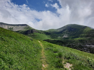
We followed the trail upward behind Rifugio Vederna.
 |
| Pony had no interest in us |
Once we reached the base (for us) of Monte Pavione, we basically followed switchbacks all the way up the mountainside.
iNaturalist says this plant is laburnum, a.k.a. golden chain or golden rain. It's toxic, and related to peas. We passed several laburnum trees on our way up.


By now, the clouds had enveloped us, and the air was drippy.
Occasionally the clouds cleared down below:


The trail never dipped. S speculated that the route was recorded by a mountain biker who fell over the steep edge of the trail and then carried their bike back up.


We decided to stop at Rifugio dal Piaz, which was on our originally planned route but required a bit of a detour from the new route.


As the clouds dissipated, we figured the extra miles we were adding by following the road wouldn't be a problem.


Before dinner, we thought we'd go for a short walk, but the weather made us turn around after a block. Here's a view of the hotel across the street from ours. It's for sale!


By now, the clouds had enveloped us, and the air was drippy.
 |
| Der Wanderer in dem Nebelmeer |
Occasionally the clouds cleared down below:


We zigged and zagged, and the trail got steeper and steeper, with steep drop-offs that I avoided looking down. We were glad the rain had stopped by the time we arrived at the steel steps and cables. Komoot hadn't warned us about them, but since we were climbing up (always easier for this acrophobe than climbing down), they were fine.


After more climbing, we finally reached the crest...

...and the clouds briefly cleared for a Wanderer ueber dem Nebelmeer shot:

Passo Pavione. The choice was now whether to continue upward to the peak, or to go around it.

As soon as we saw the clouds rolling in on the other side of the pass, we decided to skip the peak and stay low. This meant hiking down to the meadow below us, and then walking around the double-cirque beneath the peak (not yet visible in the photo below).

The wildflowers were thriving in the meadows. The pink-purple ones below are water avens, and until later Tuesday afternoon, this is how I'd always seen them look:

In the middle of the completely socked-in meadow were a 1902 building and stable of the Corpo Forestale dello Stato--the State Forestry Corps, founded in 1822 as a police force to protect Italy's agro-forestry interests. The trail signage next to the building appeared to have been adjusted by either snow or people, and the signs were pointing in the wrong directions.

The main forestry corps building...

...was clearly designed with defense in mind:

No donkeys in the stables...

The shifting mists were dramatic, but we wondered what panoramas we were missing.

The trail took us out of the meadow and began to follow the curve of the mountainside. While the terrain appeared to be relatively even, our Komoot map warned us of a sudden dip, and since we couldn't see anything downhill below the trail, we proceeded with caution.
.png) |
| The mysterious dip |
The trail never dipped. S speculated that the route was recorded by a mountain biker who fell over the steep edge of the trail and then carried their bike back up.
Soggy and ready for a break, we decided to pause mid-trail to eat a snack of chocolate-pear cake, carried in our packs from Rifugio Vederna.


The clouds below the trail began to clear while we snacked...

...and suddenly the sun appeared. The lighting was similar to the partial light just before and after a solar eclipse reaches totality: clearly daylight, yet oddly dim.


As the trail began to curve around the double cirque, we encountered bright blue skies.

We had seen a lot of wildflower-filled meadows on this trip, but nothing matched the abundance of globeflowers in the cirque. The photos don't do the spread justice.

 |
| Can you spot S's green backpack cover? |
We decided to stop at Rifugio dal Piaz, which was on our originally planned route but required a bit of a detour from the new route.

The Rifugio is at the top of a popular descent for mountain bikers, so signs laid out detailed cycling comportment rules (mainly be careful, and don't squash the pedestrians).

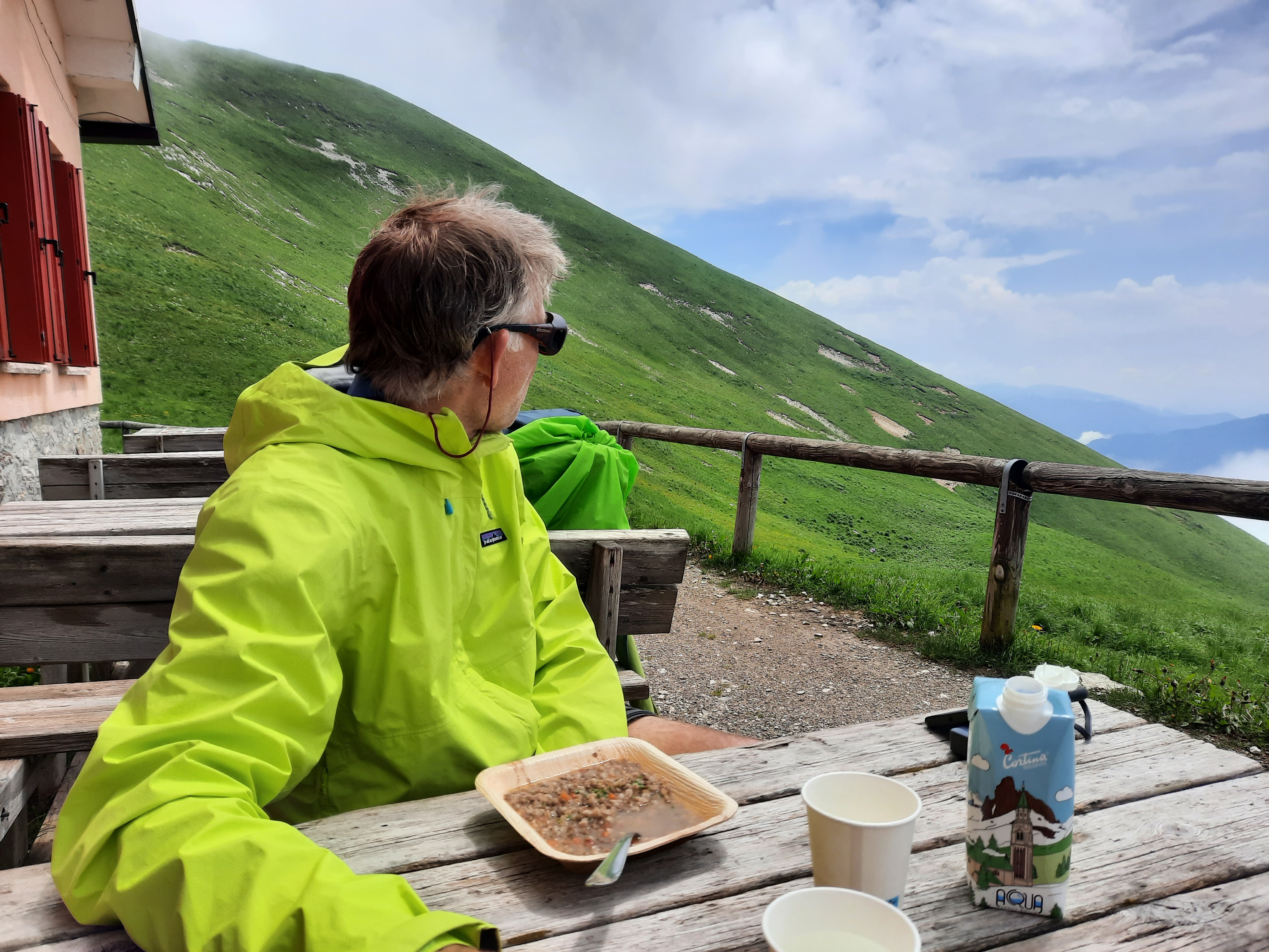
We sat outside at the refuge and enjoyed some welcome lentil-barley soup laced with sherry as the clouds moved in...

...and out.
Although our planned route had us cutting across some of the switchbacks in the road, we ended up just following the road all the way down the mountain to the saddle where our hotel for the night was situated. This was easier on our knees, and given the ridiculous steepness of some of the cut-throughs, a smart choice for the acrophobe.


Switchbacks. This was another WWI Italian military road and it had a zillion switchbacks...

...but goodness, check out the impressively consistent grade!
.2.png) |
| The red star marker is Rifugio dal Piaz |
As the clouds dissipated, we figured the extra miles we were adding by following the road wouldn't be a problem.


More switchbacks...


Gradually we descended low enough to enter the woods. If you google "Rifugio dal Piaz wood sculpture underpants," you don't get any images of the expressive larger-than-life tour de force shown below, yet here it is. Notice the rodent of unusual size perched on its shoulder.

We passed a real treat of a flower (for me, at least): a water avens blossom open beyond hanging bud-hood.


After a long stretch of sunlight, accompanied by much hubris about walking extra miles without getting poured on, we got a good view of the hill above Croce d'Aune and a good listen to the accompanying thunder. We were still only about halfway down to the saddle. We checked radar maps and decided to hunker down for about 15 minutes, and the storm skipped us entirely.


There aren't many photos of the rest of the trip down, because shortly after S retied his shoelaces (below), the thunder started up again and we skedaddled down the road. We passed a stretch that had been washed out by a landslide and was being repaired by a group of workers using heavy equipment; they seemed completely nonchalant about the ominous weather. A few switchbacks below that, we heard a crunching sound, S yelled "rock! rock!" (although it might have been a tree), and we scooched as close to the mountain side as we could. We didn't get hit by any falling rocks or trees, but we did finally get caught in a loud, heavy, hail-spattering thunderstorm. We were grateful for the woods, which offered some protection, and grateful that the hailstones were small enough not to rip holes in our umbrellas or heads.

I had intentionally practiced walking in deluges a few times over the past year, to learn not to be annoyed by getting drenched, so I was happy to finally put those drenchings to good use. Once the storm passed, Mr. "OK with just putting on the rain gear and getting wet" was very wet, but not particularly OK with it. As an acrophobe, I should be the last person to tease him about this, especially after his patience with me at the Waterfall Crossings of Doom a few days prior, but it was hard not to laugh. We were soaked, yet undamaged, and a warm shower and dinner surely awaited us in Croce d'Aune below.
This photo--we don't even look all that wet!--

reminds me a little of the photo I took post-gondola lift atop Seceda. Compare and contrast.

The switchbacking road continued at the same easy grade all the way down into Croce d'Aune. We checked into the Albergo, took off our soaking boots and clothes, and took hot showers.
The view from our room was of Feltre--our destination for the next day, and the end of our hike across the Alps. The foothills beyond Feltre looked more mountain-y than foothill-y to me, but the interwebs insist that Feltre is in the foothills of the Dolomites, so we're going with that. S also notes that the Alta Via 2 delle Dolomiti ends in Feltre.


At dinner, we successfully avoided polenta with cheese puddle. Shown here is possibly one of the few good things one can do with stinging nettles: cook them into risotto.

Ta da! 13.5 miles, 2,830 ft elevation gain, 3,860 ft descent. Almost done!


No comments:
Post a Comment